
Badr Battlefield Masterplan
2023
Bedir Tarihi Merkezi’ni Geliştirme ve Koruma Master Plan Projesi, İslam tarihine önemli etkisiyle manevi bir ziyaret noktası olan Bedir şehrinin tarihi ve kültürel mirasını korumayı amaçlayan sürdürülebilir bir kentsel dönüşüm planı. Proje, ulaşım ve yerleşim stratejilerini düzenlemeyi, yerel mimari dokuyu onarmayı, tarihi savaş alanını koruyarak ziyaretçi ihtiyaçlarına uygun hale getirmeyi ve yeni konut alanlarıyla şehrin gelişim planlamasını yapmayı hedefliyor.
The Master Plan Project for the Development and Conservation of the Badr Historical Center is a sustainable urban transformation plan aimed at preserving the historical and cultural heritage of the city of Badr, which holds significant spiritual importance in Islamic history. The project aims to regulate transportation and settlement strategies, restore the local architectural fabric, preserve the historic battlefield while adapting it to visitor needs, and plan the development of the city with new residential areas.
Location
Badr, Saudi ArabiaConstruction Area
720.000 m²Client
Al-Madinah Al-Munawarah Development Authority (MDA)Project Team
Ethem Aybar, Ece Ünübol, Yıldırım Erbaz, Nusret Uşun, Mehmet Kaymaz, Mehmet Erdönmez, Enver Yiğit Doğan, Aleyna İzmirli, Yağız Ateşoğlu
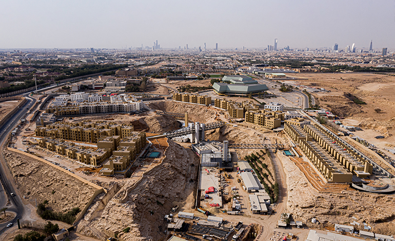
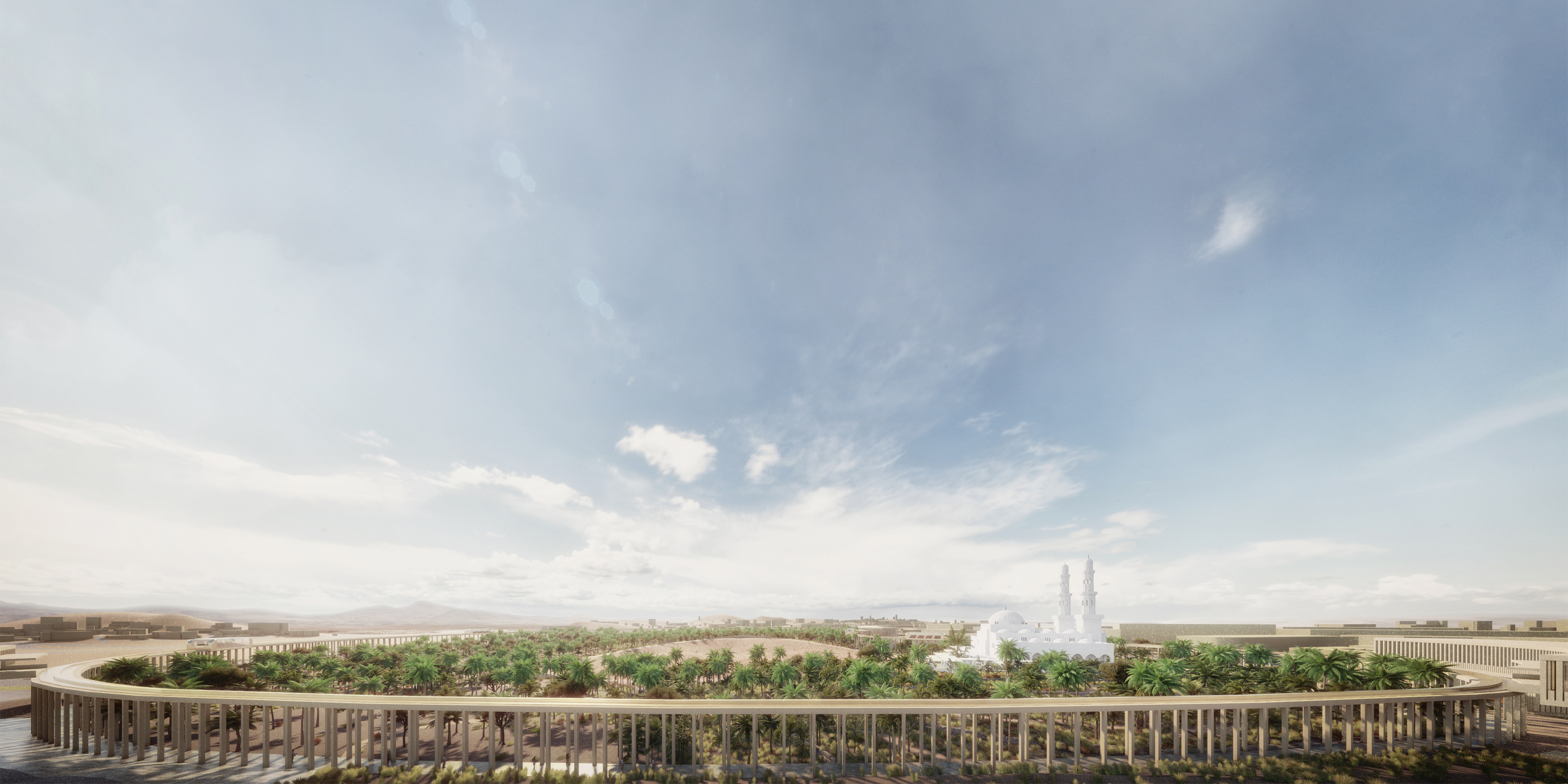
Master plan, eşmerkezli alanlardan oluşan tavaf (döngü) konseptine dayanıyor ve ziyaretçilere panoramik bir deneyim sunarken etaplamalar için uygulanabilir bir temel sağlıyor. Alanlar farklı işlev ve planlama seviyeleriyle tanımlı. Monoray ve sergi mekânı olarak işlev gören 1.75 kilometrelik portiko, bu bölgeleri birbirine bağlıyor. Planlanan bölgeler; yeni konut yerleşimi, restore edilen tarihi merkez, tarım enstitüsü, mezarlık, savaş alanı ve müze / istasyonlardan oluşuyor.
The master plan is based on a concentric ring (tawaf) concept, providing a panoramic and structured visitor experience while allowing for phased construction. Different zones are defined with specific functions and planning levels. A 1.75-kilometer long portico, serving as both a monorail route and exhibition space, connects these zones. Planned areas include new residential settlements, the restored historic center, an agricultural institute, a cemetery, the battlefield, and museum / stations.


Konsantrik alanların merkezinde, Bedir Savaşı’nı sembolize eden ve portikonun yeşil bitki örtüsüyle kaplı bir açıklık yer alıyor. Aralarındaki fiziksel tezat tarihsel bağlamı güçlendiriyor. Monoray, Arabistan’ın sert iklimine karşı konforlu ve panoramik bir deneyim sağlıyor. Monoray hattı üzerindeki müze / istasyonlar, savaşın kronolojik ve mekansal sırasına göre dizili.
At the center of the concentric rings, an open space symbolizes the Battle of Badr. This area is surrounded by greenery within the portico. The physical contrast between them strengthens the historical context. A monorail offers visitors a comfortable and panoramic experience, providing shelter from the harsh Arabian climate. Along the monorail route, museum / stations are positioned to reflect the chronological and spatial sequence of the battle.


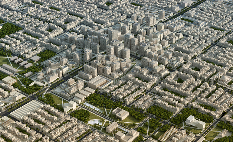
Altyapı ve dolaşım ağı yeniden ele alındı ve tarihi merkezin içinden geçen geniş cadde kaldırılarak şehrin mekansal karakterini tanımlayan bir bulvar tasarlandı. Bulvar, Bedir’i çevre yerleşimlere bağlayan giriş ve servis alanlarını içeriyor. Konut yerleşimi ve tarihi merkez, hem ziyaretçiler hem de şehir sakinleri için tasarlandı. Antik kent dokusu rehabilite edilerek, yeni programlarla canlandırıldı ve yeni yapıların kalitesini artırmaya odaklanıldı.
The city’s infrastructure and transportation network have been restructured. A wide road cutting through the historic center has been removed, and a new boulevard defining the city’s spatial character has been designed at the outermost ring. This boulevard links Badr to nearby settlements and acts as an entrance and service area. The residential and historic areas are planned for both visitors and local residents. The ancient urban fabric has been rehabilitated and revitalized with new programs. Additionally, the quality of new constructions has been improved.


Geliştirilen master plan, tarihi dokuyu koruyarak, altyapı sorunlarına çözüm getiriyor ve Bedir’in kültürel değerlerini öne çıkarıyor. Tanımlı bir kent merkezi ve oluşturulan ulaşım haritasıyla tarihi merkez restore edilirken, savaş alanı panoramik bir deneyim rotasıyla ziyaretçiler için nitelikli bir mekâna dönüşüyor.
By protecting the historic fabric and addressing infrastructure challenges, the project highlights Badr’s cultural and historical significance. A defined city center and transportation map have been created, restoring the historic center and enhancing the battlefield’s spatial quality with a panoramic visitor route.